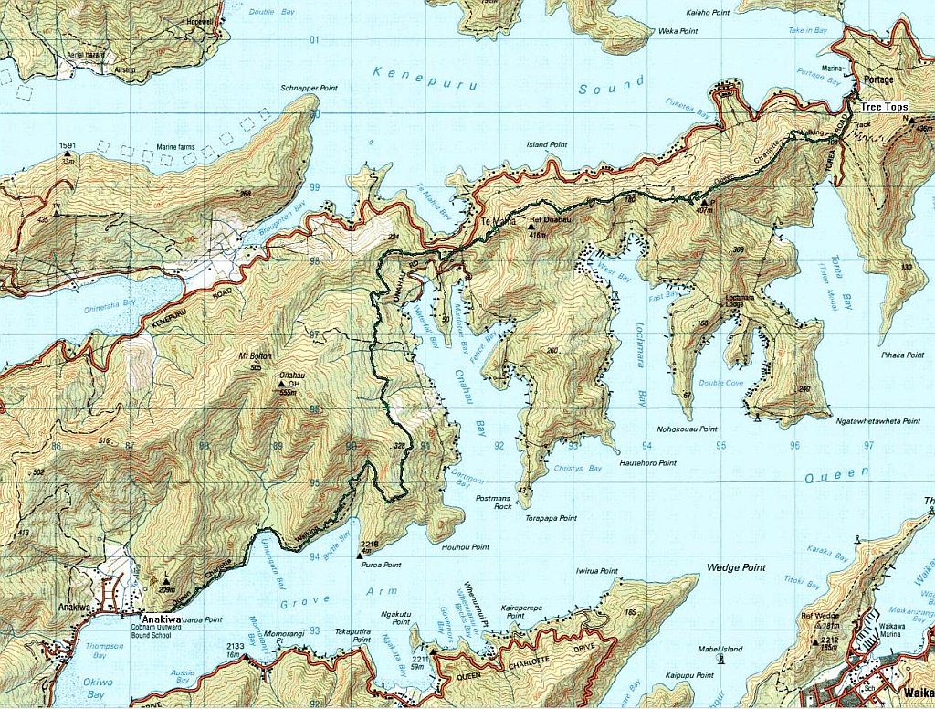
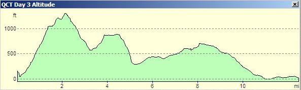
Actual distance walked: 12.5 miles
Total time on the track: 6:20 hours
Total Ascent: 2142 feet
| Leg | Name | Distance in miles |
Ascent in feet |
Time in minutes |
Clock | Photos |
| 0 | Tree Tops | 49 | 08:30 | Portage Bay | ||
| 1 | Torea Saddle | 0.61 | 282 | 15 | 08:50 | Portage |
| 2 | Torea Bay | 0.96 | 1047 | 40 | 09:30 | Torea Bay |
| 3 | The Path | 0.27 | 1204 | 10 | 09:40 | Pig disturbance, View ahead |
| 4 | High Point | 0.17 | 1302 | 5 | 09:45 | Allports Island, Waitaria Bay |
| 5 | Kenepuru Sound | 0.44 | 1129 | 20 | 10:05 | Kenepuru Sound, West Bay |
| 6 | Looking back | 1.05 | 614 | 25 | 10:30 | Looking back |
| 7 | Onahau | 0.31 | 866 | 10 | 10:40 | |
| 8 | Coffee | 0.76 | 856 | 20 | 11:00 | Puketea Bay, & Te Mahia Bay |
| 9 | Onahau Road | 0.59 | 302 | 15 (+15) | 11:30 | |
| 10 | Lunch | 2.48 | 600 | 55 | 12:25 | Onahau Bay, Waterfall Bay |
| 11 | Bottle Bay | 1.49 | 623 | 25 (+40) | 13:30 | Bottle Bay |
| 12 | Beech Woods | 0.88 | 367 | 20 | 13:50 | Beech Woods |
| 13 | Umungata Bay | 1.27 | 0 | 25 | 14:15 | Umungata Bay |
| 14 | Anakiwa | 1.5 | 0 | 35 | 14:50 | Picton ferry, Picton |