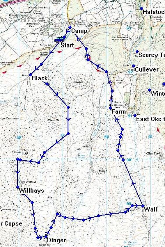
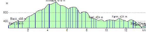
Route Distance: 14 km
Estimated Time: 3:47
Total Ascent: 412 m
| Leg | Name, Elevation | Direction | Distance | Ascent | Time |
|
0 |
Start, 354 m | ||||
|
1 |
Black, 408 m | 220°M | 1 km | 54 m | 0:18 |
|
2 |
Willhays, 619 m | 185°M | 3.83 km | 227 m | 1:13 |
3 |
Wall, 424 m | 097°M | 4.11 km | 43 m | 0:58 |
|
4 |
Farm, 431 m | 341°M | 2.43 km | 54 m | 0:37 |
|
5 |
Camp, 339 m | 332°M | 2.22 km | 20 m | 0:31 |
|
6 |
Start, 354 m | 214°M | 412 m | 15 m | 0:06 |