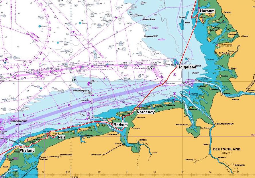
Vlieland to Hornum - GPS 199.9 miles, Log 206.5 miles
9 days - 5 sailing, 2 tide, 2 wind
Photo selection
Waypoints
| Leg |
Start Location |
Date |
Distance (GPS) |
Time |
Arrival \ Comments |
| 1 |
Vlieland |
19th May |
34.5 miles |
7:20 |
Anchor off Nes |
| 2 |
Ameland |
20th May |
50.3 miles |
8:55 |
Borkum Yachthaven |
| - |
Borkum |
21st May |
- |
- |
visit town, bad tides |
| - |
Borkum |
22nd May |
- |
- |
await wind & tide |
| 3 |
Borkum |
23rd May |
31.1 miles |
6:00 |
Nordeney Yacht Harbour |
| 4 |
Nordeney |
24th May |
42.8 miles |
9:05 |
Helgoland Harbour |
| - |
Helgoland |
25th May |
- |
- |
rain & tides |
| - |
Helgoland |
27th May |
- |
- |
visit island, wind |
| 5 |
Helgoland |
27th May |
41.2 miles |
7:55 |
Hornum anchorage |
Overview Map